According to insights from Future Data Stats, the Satellite Surveillance Market was valued at USD 10 billion in 2025. It is expected to grow from USD 11.1 billion in 2026 to USD 24 billion by 2033, registering a CAGR of 11% during the forecast period (2026–2033).
MARKET OVERVIEW:
The Satellite Surveillance Market serves a critical purpose by enabling continuous, high-resolution monitoring of Earth for defense, security, environmental tracking, and commercial intelligence. Organizations deploy advanced satellites to capture real-time imagery, detect patterns, and support rapid decision-making across borders and industries. This market empowers governments and enterprises to strengthen situational awareness, reduce risks, and unlock data-driven strategies that enhance operational efficiency and global competitiveness.
""Satellite surveillance transforms raw orbital data into real-time intelligence, enabling faster decisions, stronger security, and scalable global monitoring across industries.""
Businesses leverage satellite surveillance to optimize logistics, monitor infrastructure, track climate changes, and secure critical assets with precision. The market drives value by delivering actionable insights through AI-powered analytics and persistent coverage, eliminating blind spots in traditional monitoring systems. As demand rises for real-time geospatial intelligence, companies invest in scalable satellite solutions to gain strategic advantages, accelerate growth, and monetize data-driven services globally.
MARKET DYNAMICS:
The market accelerates with AI-powered analytics, LEO constellations, and real-time imaging demand. Emerging trends include cloud-based geospatial platforms and IoT integration, expanding business scope across defense, agriculture, and smart cities. ""Advanced satellite networks unlock scalable intelligence, enabling industries to act faster with precision-driven insights globally."" Companies capitalize on data monetization and predictive analytics to strengthen competitive positioning.
Rising demand for real-time intelligence drives growth, while high costs and regulatory limits restrain expansion. Opportunities emerge through AI integration, small satellite deployments, and climate monitoring solutions. ""Market momentum grows as innovation reduces costs and expands access to actionable satellite intelligence across industries globally."" Companies leverage these shifts to capture new revenue streams and enhance service scalability
SATELLITE SURVEILLANCE MARKET SEGMENTATION ANALYSIS
BY TYPE:
Earth observation satellites dominate due to rising demand for real-time geospatial intelligence across agriculture, defense, and climate tracking. Governments and enterprises increasingly rely on high-resolution imaging to monitor land use, infrastructure growth, and environmental shifts. Communication satellites further accelerate adoption by enabling seamless data transmission, supporting surveillance continuity in remote areas. Navigation satellites strengthen positioning accuracy, which enhances surveillance precision. Together, these systems form an integrated ecosystem that improves operational efficiency and decision-making capabilities across industries seeking dependable satellite-based monitoring solutions.
""Rising demand for real-time geospatial intelligence is accelerating adoption of integrated satellite systems across defense, agriculture, and environmental monitoring sectors.""
Reconnaissance satellites are gaining traction as defense agencies prioritize national security and intelligence superiority. Their ability to capture high-frequency, classified data positions them as critical assets in modern warfare strategies. Weather satellites also play a vital role, supporting predictive analytics for disaster preparedness and climate monitoring. Increasing investments in multi-functional satellites are reshaping this segment, enabling hybrid capabilities. This convergence of technologies is driving procurement strategies, as stakeholders seek versatile satellite platforms that deliver enhanced coverage, accuracy, and long-term operational value.
BY APPLICATION:
Defense and intelligence applications lead the market, driven by escalating geopolitical tensions and the need for continuous surveillance capabilities. Governments are investing heavily in satellite systems to enhance border monitoring, threat detection, and strategic planning. Environmental monitoring is also expanding rapidly, as climate change concerns push organizations to adopt satellite-based observation tools. These applications enable precise tracking of deforestation, pollution, and natural resource usage, reinforcing their value in sustainability initiatives and regulatory compliance across global industries.
""Satellite surveillance is becoming indispensable for national security and sustainability, driving multi-sector adoption and long-term investment across global markets rapidly.""
Disaster management and agriculture monitoring are emerging as high-growth areas, fueled by the need for predictive insights and resource optimization. Satellites enable early warning systems, helping authorities mitigate risks from floods, wildfires, and storms. Urban planning and smart city initiatives leverage satellite data for infrastructure mapping and traffic management. Maritime surveillance and border security further strengthen demand, ensuring safe navigation and preventing illegal activities. This broad application spectrum highlights the market’s expanding role in both public safety and commercial innovation.
BY COMPONENT:
Hardware remains the backbone of the satellite surveillance market, with satellite systems, ground control stations, and advanced sensors driving infrastructure investments. Continuous innovation in imaging technologies enhances resolution and data accuracy, making hardware a critical differentiator. Ground control stations ensure seamless communication and mission management, while sensors enable precise data capture across diverse environments. Increasing demand for high-performance components is pushing manufacturers to develop cost-efficient, scalable solutions that meet evolving surveillance requirements across industries.
""Advanced hardware integration is redefining surveillance capabilities, enabling higher resolution imaging and improved data transmission across complex satellite ecosystems globally.""
Software is rapidly gaining importance as organizations prioritize data interpretation and actionable insights. Data processing software and analytics platforms transform raw satellite data into meaningful intelligence, supporting faster decision-making. Services such as data acquisition, image processing, and consulting further enhance value delivery, enabling end-users to maximize system efficiency. The growing emphasis on end-to-end solutions is driving partnerships between hardware providers and software developers, creating integrated offerings that strengthen market competitiveness and customer retention.
BY ORBIT TYPE:
Low Earth Orbit (LEO) satellites dominate due to their proximity to Earth, enabling high-resolution imaging and low-latency data transmission. Their cost-effectiveness and suitability for large constellations make them ideal for real-time surveillance applications. Medium Earth Orbit (MEO) satellites provide balanced coverage and are widely used for navigation and communication purposes. Increasing deployment of LEO constellations is transforming the market, offering enhanced revisit rates and continuous monitoring capabilities that meet the growing demand for timely and accurate data.
""LEO satellite constellations are revolutionizing surveillance by delivering real-time insights with lower latency and higher revisit frequencies than traditional systems.""
Geostationary Orbit (GEO) satellites maintain a fixed position relative to Earth, making them essential for continuous monitoring and weather observation. Their wide coverage area supports large-scale surveillance operations, particularly in communication and meteorological applications. While GEO satellites involve higher costs, their ability to provide uninterrupted data streams ensures their relevance. The combination of LEO, MEO, and GEO systems is enabling hybrid architectures, allowing organizations to optimize performance, coverage, and cost efficiency across diverse surveillance needs.
BY END-USER:
Government and defense agencies represent the largest end-user segment, driven by increasing investments in national security and intelligence infrastructure. These organizations rely heavily on satellite surveillance for border control, threat detection, and strategic operations. The demand for advanced surveillance technologies continues to grow as geopolitical uncertainties intensify. Governments are also focusing on indigenous satellite development programs, further strengthening market expansion and reducing dependency on external providers.
""Government investments in satellite surveillance are surging, driven by security priorities and the need for autonomous intelligence capabilities across regions globally.""
Commercial enterprises are rapidly adopting satellite surveillance to enhance operational efficiency and gain competitive advantages. Industries such as agriculture, logistics, and energy leverage satellite data for monitoring assets and optimizing resources. Research and academic institutions also contribute to market growth by driving innovation and developing advanced analytical models. Collaboration between public and private sectors is fostering technological advancements, enabling broader adoption and creating new revenue streams across the satellite surveillance ecosystem.
BY TECHNOLOGY:
Optical imaging dominates the technology segment due to its ability to deliver high-resolution visual data for diverse applications. It is widely used in urban planning, agriculture, and environmental monitoring. Radar imaging (SAR) is gaining momentum as it provides all-weather, day-and-night surveillance capabilities. This makes it highly valuable for defense and disaster management applications. Continuous advancements in imaging technologies are enhancing data accuracy and expanding use cases, driving strong demand across sectors.
""Advanced imaging technologies are enhancing data accuracy and reliability, expanding the scope of satellite surveillance across multiple high-value applications globally.""
Hyperspectral imaging is emerging as a powerful tool for detailed analysis, enabling detection of materials and environmental changes at a granular level. Multispectral imaging offers cost-effective solutions for broader applications, balancing performance and affordability. The integration of multiple imaging technologies is creating hybrid systems that deliver comprehensive insights. This technological evolution is attracting significant investments, as organizations seek advanced capabilities to address complex surveillance challenges and improve decision-making processes.
BY PLATFORM:
Small satellites (SmallSats) are transforming the market by offering cost-effective and scalable solutions for surveillance operations. Their compact size and lower deployment costs enable rapid constellation development, making them highly attractive for commercial and government applications. CubeSats further enhance accessibility, allowing smaller organizations and research institutions to participate in satellite missions. These platforms are driving innovation and democratizing access to satellite surveillance technologies.
""Small satellite platforms are democratizing access to space-based surveillance, enabling faster deployment and cost-efficient data acquisition across industries globally.""
Large satellites continue to play a crucial role in high-capacity and long-duration missions, offering superior power and advanced capabilities. They are preferred for complex surveillance operations requiring extensive coverage and reliability. The coexistence of small and large satellite platforms is creating a balanced ecosystem, where organizations can choose solutions based on specific operational needs. This diversity is strengthening market growth, ensuring flexibility, scalability, and sustained technological advancement across the satellite surveillance landscape.
REGIONAL ANALYSIS:
North America leads the Satellite Surveillance Market by driving strong investments in defense modernization, space innovation, and commercial geospatial intelligence. The United States and Canada actively deploy advanced satellite constellations to enhance national security and disaster response capabilities. Europe follows with robust regulatory frameworks and collaborative space programs that strengthen cross-border surveillance and environmental monitoring. Asia Pacific accelerates growth through rising defense budgets, expanding space programs, and rapid adoption of satellite data in agriculture, urban planning, and maritime security, positioning the region as a high-growth hub for investors.
""Regional investments in satellite surveillance accelerate global intelligence capabilities, enabling faster response, enhanced security, and scalable data-driven decision-making worldwide.""
Latin America demonstrates steady adoption as governments and private sectors integrate satellite surveillance for resource management, border control, and infrastructure monitoring. The Middle East & Africa region gains momentum through increasing demand for security solutions, oil and gas monitoring, and smart city initiatives. Governments across these regions actively invest in satellite technologies to strengthen resilience, improve operational visibility, and unlock new commercial opportunities, creating attractive entry points for market players seeking expansion and long-term revenue growth.
RECENT DEVELOPMENTS:
- In March 2026 – Capella Space launched its第三代 Acadia 3 satellite with 0.2m resolution, enhancing real-time Earth observation for defense surveillance.
- In February 2026 – EU signed €1.2B contract with Airbus and Thales to expand IRIS² surveillance constellation, adding 10 optical satellites by Q4 2026.
- In January 2026 – SpaceX deployed 12 Starshield satellites for NRO, dedicated to persistent global military surveillance and data relay.
- In November 2025 – China’s Gaofen-14 launched, featuring sub-meter radar surveillance for maritime and border monitoring.
- In September 2025 – Maxar Intelligence unveiled AI-powered change detection software for its WorldView Legion fleet, cutting surveillance revisit time to 30 minutes.
KEY MARKET PLAYERS:
- Airbus Defence and Space
- Thales Alenia Space
- SpaceX (Starshield)
- Maxar Technologies
- Capella Space
- Planet Labs
- BlackSky Global
- ICEYE
- Lockheed Martin
- Northrop Grumman
- Raytheon Technologies
- Boeing
- L3Harris Technologies
- Telespazio
- ImageSat International
- Satellogic
- Surrey Satellite Technology Ltd (SSTL)
- China Aerospace Science and Technology Corporation (CASC)
- Russian Space Systems
- KHALIFA University (Satellite Surveillance division)
Satellite Surveillance Market-Table of Contents
1. Introduction
- 1 Market Definition
- 2 Scope of the Study
- 3 Research Objectives
- 4 Assumptions & Limitations
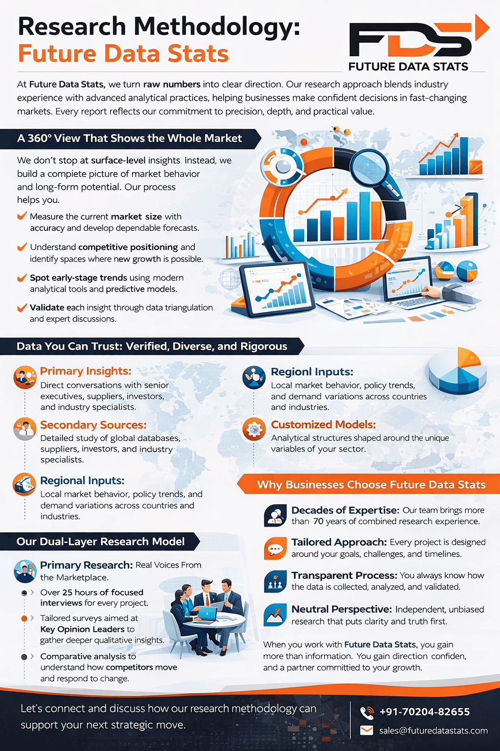
- 5 Research Methodology
- 5.1 Data Collection Methods
- 5.2 Primary Research
- 5.3 Secondary Research
- 5.4 Data Validation & Triangulation
2. Executive Summary
- 1 Market Overview
- 2 Key Findings
- 3 Market Snapshot
- 4 Key Trends
- 5 Analyst Recommendations
3. Market Dynamics
- 1 Market Drivers
- 2 Market Restraints
- 3 Market Opportunities
- 4 Market Challenges
- 5 Impact Analysis
4. Market Factor Analysis
- 1 Value Chain Analysis
- 2 Supply Chain Analysis
- 3 Pricing Analysis
- 4 Technology Landscape
- 5 Regulatory Framework
- 6 Porter's Five Forces Analysis
- 6.1 Threat of New Entrants
- 6.2 Bargaining Power of Suppliers
- 6.3 Bargaining Power of Buyers
- 6.4 Threat of Substitutes
- 6.5 Competitive Rivalry
5. Satellite Surveillance Market – By Type
- 1 Overview
- 2 Earth Observation Satellites
- 3 Communication Satellites
- 4 Navigation Satellites
- 5 Reconnaissance Satellites
- 6 Weather Satellites
6. Satellite Surveillance Market – By Application
- 1 Overview
- 2 Defense & Intelligence
- 3 Environmental Monitoring
- 4 Disaster Management
- 5 Agriculture Monitoring
- 6 Urban Planning & Smart Cities
- 7 Maritime Surveillance
- 8 Border & Coastal Security
7. Satellite Surveillance Market – By Component
- 1 Overview
- 2 Hardware
- 2.1 Satellite Systems
- 2.2 Ground Control Stations
- 2.3 Sensors & Imaging Systems
- 3 Software
- 3.1 Data Processing Software
- 3.2 Analytics Platforms
- 4 Services
- 4.1 Data Acquisition
- 4.2 Image Processing
- 4.3 Consulting & Maintenance
8. Satellite Surveillance Market – By Orbit Type
- 1 Overview
- 2 Low Earth Orbit (LEO)
- 3 Medium Earth Orbit (MEO)
- 4 Geostationary Orbit (GEO)
9. Satellite Surveillance Market – By Technology
- 1 Overview
- 2 Optical Imaging
- 3 Radar Imaging (SAR)
- 4 Hyperspectral Imaging
- 5 Multispectral Imaging
10. Satellite Surveillance Market – By Platform
- 1 Overview
- 2 Small Satellites (SmallSats)
- 3 CubeSats
- 4 Large Satellites
11. Satellite Surveillance Market – By End-User
- 1 Overview
- 2 Government & Defense Agencies
- 3 Commercial Enterprises
- 4 Research & Academic Institutions
12. Satellite Surveillance Market – By Region
- 1 Overview
- 2 North America
- 2.1 U.S.
- 2.2 Canada
- 3 Europe
- 3.1 Germany
- 3.2 UK
- 3.3 France
- 3.4 Rest of Europe
- 4 Asia-Pacific
- 4.1 China
- 4.2 India
- 4.3 Japan
- 4.4 South Korea
- 4.5 Rest of Asia-Pacific
- 5 Middle East & Africa
- 5.1 GCC
- 5.2 South Africa
- 5.3 Rest of MEA
- 6 Latin America
- 6.1 Brazil
- 6.2 Mexico
- 6.3 Rest of Latin America
13. Competitive Landscape
- 1 Market Share Analysis
- 2 Competitive Benchmarking
- 3 Key Strategies
- 4 Recent Developments (Mergers, Acquisitions, Partnerships)
14. Company Profiles
- 1 Company Overview
- 2 Financial Overview
- 3 Product Portfolio
- 4 Strategic Initiatives
- 5 SWOT Analysis
15. Future Outlook & Forecast
- 1 Market Size Forecast (2026–2035)
- 2 Growth Trends
- 3 Emerging Technologies
- 4 Investment Opportunities
List of Figures
- Figure 1: Satellite Surveillance Market Research Methodology
- Figure 2: Market Size Estimation Model
- Figure 3: Market Dynamics Overview
- Figure 4: Value Chain Analysis
- Figure 5: Porter’s Five Forces Analysis
- Figure 6: Market Share by Type
- Figure 7: Market Share by Application
- Figure 8: Market Share by Component
- Figure 9: Market Share by Orbit Type
- Figure 10: Market Share by Technology
- Figure 11: Market Share by Platform
- Figure 12: Market Share by End-User
- Figure 13: Regional Market Share Analysis
- Figure 14: Competitive Landscape Overview
- Figure 15: Forecast Growth Trends
List of Tables
- Table 1: Market Definition & Scope
- Table 2: Key Assumptions
- Table 3: Market Drivers Impact Analysis
- Table 4: Market Restraints Impact Analysis
- Table 5: Market Opportunities Analysis
- Table 6: Satellite Surveillance Market by Type (2026–2035)
- Table 7: Market by Application (2026–2035)
- Table 8: Market by Component (2026–2035)
- Table 9: Market by Orbit Type (2026–2035)
- Table 10: Market by Technology (2026–2035)
- Table 11: Market by Platform (2026–2035)
- Table 12: Market by End-User (2026–2035)
- Table 13: Market by Region (2026–2035)
- Table 14: Company Market Share Analysis
- Table 15: Key Company Profiles Comparison
Satellite Surveillance Market Segmentation
By Type:
- Earth Observation Satellites
- Communication Satellites
- Navigation Satellites
- Reconnaissance Satellites
- Weather Satellites
By Application:
- Defense & Intelligence
- Environmental Monitoring
- Disaster Management
- Agriculture Monitoring
- Urban Planning & Smart Cities
- Maritime Surveillance
- Border & Coastal Security
By Component:
- Hardware
- Satellite Systems
- Ground Control Stations
- Sensors & Imaging Systems
- Software
- Data Processing Software
- Analytics Platforms
- Services
- Data Acquisition
- Image Processing
- Consulting & Maintenance
By Orbit Type:
- Low Earth Orbit (LEO)
- Medium Earth Orbit (MEO)
- Geostationary Orbit (GEO)
By End-User:
- Government & Defense Agencies
- Commercial Enterprises
- Research & Academic Institutions
By Technology:
- Optical Imaging
- Radar Imaging (SAR)
- Hyperspectral Imaging
- Multispectral Imaging
By Platform:
- Small Satellites (SmallSats)
- CubeSats
- Large Satellites
By Geography:
- North America (USA, Canada, Mexico)
- Europe (UK, Germany, France, Italy, Spain, Rest of Europe)
- Asia-Pacific (China, Japan, Australia, South Korea, India, Rest of Asia-Pacific)
- South America (Brazil, Argentina, Rest of South America)
- Middle East and Africa (GCC Countries, South Africa, Rest of MEA)
Satellite Surveillance Market Dynamic Factors
Drivers:
- Governments increase spending on defense and border surveillance systems.
- Enterprises demand real-time geospatial intelligence for faster decisions.
- Advancements in AI and high-resolution imaging improve data accuracy.
Restraints:
- High satellite deployment and maintenance costs limit adoption.
- Strict regulations and data privacy concerns slow market expansion.
- Limited technical expertise restricts efficient data utilization.
Opportunities:
- Growing use of small satellites reduces operational costs.
- Expansion of smart cities boosts demand for continuous monitoring.
- Rising climate monitoring needs create new commercial applications.
Challenges:
- Managing massive data volumes strains processing capabilities.
- Signal interference and space debris impact satellite performance.
- Intense competition pressures pricing and profit margins.
Satellite Surveillance Market Regional Key Trends
North America:
- Expands LEO satellite constellations for real-time intelligence.
- Integrates AI-driven analytics into defense operations.
- Increases private sector investment in space technologies.
Europe:
- Strengthens cross-border surveillance collaborations.
- Focuses on environmental and climate monitoring programs.
- Promotes regulatory frameworks for secure data sharing.
Asia Pacific:
- Accelerates national space missions and satellite launches.
- Adopts satellite data in agriculture and urban planning.
- Boosts defense capabilities with advanced surveillance systems.
Latin America:
- Uses satellite imaging for natural resource management.
- Improves border security with surveillance technologies.
- Expands public-private partnerships in space initiatives.
Middle East & Africa:
- Invests in satellite systems for oil and gas monitoring.
- Develops smart city projects using geospatial data.
- Enhances security infrastructure with surveillance solutions.
Frequently Asked Questions